
Skip to content
The Sanctuary

Reviewed by the Discover The Sanctuary editorial team · Updated

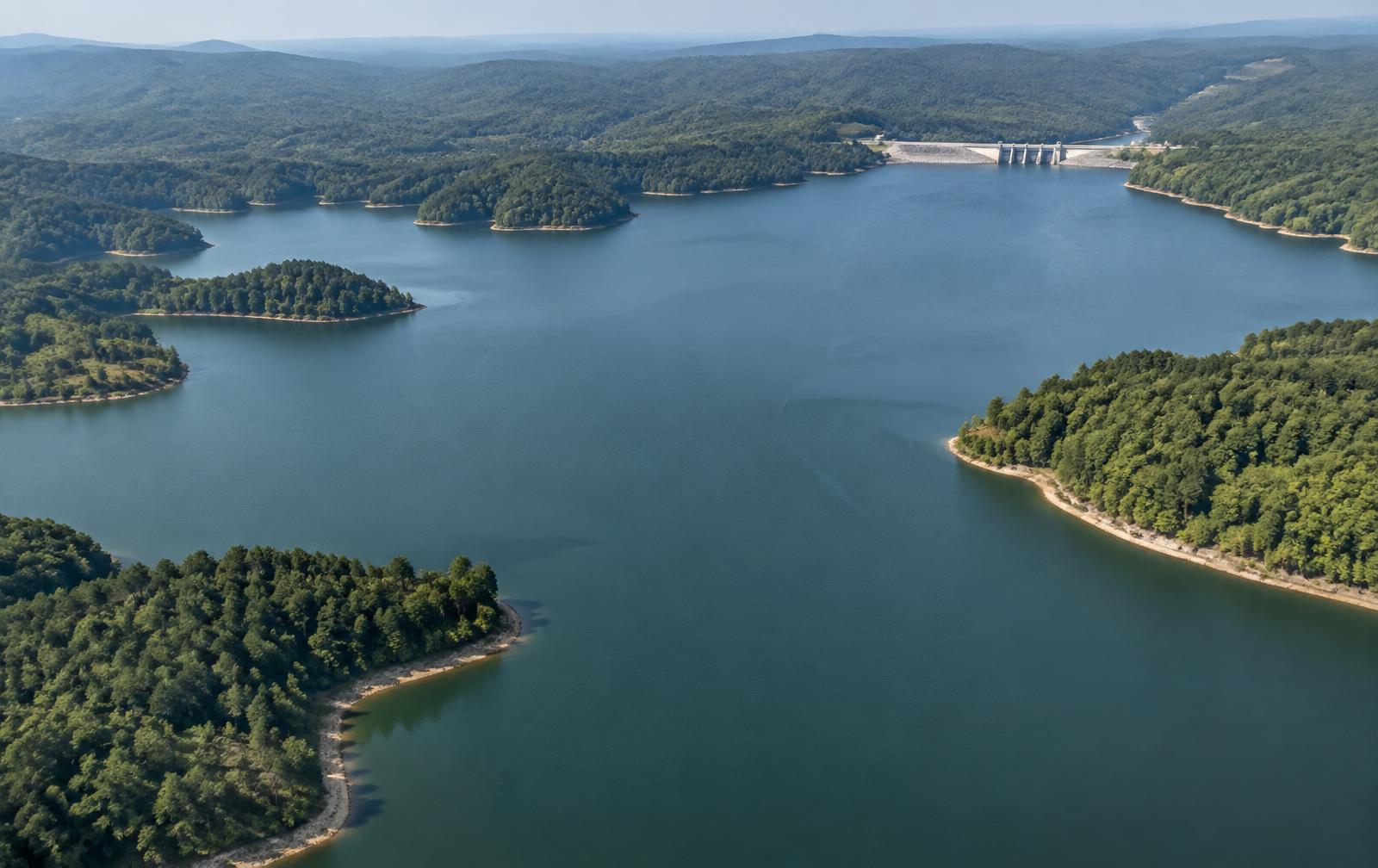
Aerial view of a wooded Carolina reservoir with coves and a distant dam on a clear morning

Local Guides

Lake Wylie Facts

How big it is, how deep it runs, whether it is man made, which state it belongs to, and who actually sets the rules on the water — answered plainly, with the primary sources named.

Lake Wylie is the oldest reservoir on the Catawba River and, for anyone weighing a move to the Charlotte area, the most misunderstood. The questions below are the ones people actually ask before they tour a shoreline — and most of the answers change how a waterfront purchase should be approached.

The Numbers at a Glance

Figures follow Duke Energy's published reservoir information and USGS gauge data for the Catawba system. Where a number moves with lake level, it is given as an approximation rather than a false precision.

Why Lake Wylie Exists

The lake was created in 1904 when the Catawba Power Company dammed the river at India Hook Shoals to generate hydroelectric power for the Carolina textile economy. The dam was raised in 1924, roughly tripling the reservoir and creating the shoreline that exists today. That history is the reason the lake feels older and more settled than its neighbours: mature hardwood shoreline, established coves, and towns that grew up facing the water rather than being built to sell it.

The State Line Runs Through the Water

Lake Wylie sits in two states at once. North Carolina holds the Mecklenburg and Gaston shoreline; South Carolina holds York County. The practical consequences are real: property tax treatment, income tax, school assignment and vessel registration all depend on which side of an invisible line a given dock sits. Buyers who shortlist the lake without settling the state question first usually end up re-touring.

Depth, Levels and What That Means for a Dock

Because Lake Wylie is run-of-river rather than a large storage reservoir, its level is held comparatively steady — typically within a foot or two of full pond. Docks stay usable through the year, which is not universally true of the bigger lakes upstream. Depth, however, varies sharply: deep water near the dam, moderate depth in the main channel, and shallow creek arms where a large boat can be a problem in a drawdown. Confirm depth at the dock, not at the property line.

Who Sets the Rules

Duke Energy holds the federal licence for the reservoir and controls shoreline management — docks, lifts, seawalls, dredging and shoreline vegetation all fall under its approval, governed by the shoreline classification assigned to each parcel. On the water, the Lake Wylie Marine Commission handles no-wake zones and buoys, with NCWRC and SCDNR enforcing their respective state boating law. Any dock plan should begin with the parcel's classification.

Lake Wylie at full pond
MeasureFigure
Surface area at full pond≈13,400 acres (about 21 square miles)
Shoreline≈325 miles
Full-pond elevation≈569.4 feet above sea level (Duke Energy target)
Maximum depth≈70 feet near the Wylie dam; most of the lake is far shallower
Average depthRoughly 20–25 feet, varying widely by arm and cove
Length≈33 miles along the main Catawba River channel
Created1904 — impounded by the Catawba Power Company, enlarged in 1924
RiverCatawba River, upstream of Fishing Creek and downstream of Mountain Island Lake
StatesBoth — the state line runs through the lake (Mecklenburg and Gaston counties NC; York County SC)
Managed byDuke Energy under a FERC licence; on-water rules by the Lake Wylie Marine Commission
Counties on the shorelineMecklenburg NC, Gaston NC, York SC
Distance to Uptown Charlotte≈20–30 minutes from most of the NC shoreline

Approximate values published by Duke Energy for the Catawba reservoir system; surface area and depth vary with lake level.

Frequently Asked

Questions About The Sanctuary

Is Lake Wylie man made?+

Yes. Lake Wylie is a man-made reservoir, created in 1904 when the Catawba Power Company dammed the Catawba River at India Hook Shoals to generate hydroelectric power. It was enlarged in 1924 when the dam was raised. That makes it the oldest lake in the Catawba chain — older than Lake Norman, which was filled in 1963.

Is Lake Wylie in North Carolina or South Carolina?+

Both. The state line runs through the lake. The northern and eastern shoreline lies in Mecklenburg and Gaston counties, North Carolina; the southern and western shoreline lies in York County, South Carolina. Practically, that means two sets of property tax rules, two school systems and two state boating agencies around one body of water.

How many acres is Lake Wylie?+

About 13,400 acres at full pond — roughly 21 square miles of water — with approximately 325 miles of shoreline. Acreage moves slightly with the lake level, which Duke Energy manages toward a full-pond elevation near 569.4 feet.

How deep is Lake Wylie?+

The deepest water is near the Wylie dam, at roughly 70 feet. Away from the dam the lake is much shallower: most of the main channel runs in the 20-to-40-foot range and many coves and creek arms are under 15 feet. Depth matters when buying waterfront, because it determines whether a dock holds water for a larger boat in a drawdown.

Is Lake Wylie clean?+

Lake Wylie is a working Catawba River reservoir that is swum in, fished and boated all season. Water clarity varies by arm and by rainfall — creek arms cloud after storms, the main channel clears faster. The Catawba Riverkeeper publishes independent bacteria monitoring for sites across the lake through the swim season, which is the honest place to check conditions before a holiday weekend rather than relying on a general claim.

What is the Lake Wylie water level today?+

Duke Energy publishes current and forecast lake levels for every Catawba reservoir, and USGS maintains river gauges on the same system. Lake Wylie is a run-of-river reservoir, so it holds level far more steadily than the big storage lakes upstream — typically within a foot or two of full pond — which is one reason docks here stay usable year-round.

Can you swim in Lake Wylie?+

Yes. Swimming is common from private docks, community beaches and public park swim areas through the warm months. Residents of The Sanctuary swim from the community's private lake beach and from their own docks. As on any reservoir, avoid swimming near dam structures, intakes and marina fuel docks, and check Riverkeeper monitoring after heavy rain.

What fish are in Lake Wylie?+

Lake Wylie is best known as a largemouth bass fishery and hosts tournaments regularly. Striped and hybrid bass, crappie, catfish, bream and perch are all abundant. Dock structure, laydowns and the quieter creek arms fish especially well in spring and fall.

Who owns and manages Lake Wylie?+

Duke Energy owns the dam and holds the federal licence for the reservoir, and it controls the shoreline management rules that govern docks, vegetation and shoreline construction. On-water rules — no-wake zones, buoys, safety enforcement — involve the Lake Wylie Marine Commission along with NCWRC and SCDNR on their respective sides.

Do you need a permit to build a dock on Lake Wylie?+

Yes. Any dock, boat lift, seawall, dredging or shoreline vegetation work requires Duke Energy shoreline approval, and the parcel's shoreline classification determines what is allowed there. County permits may apply as well. Confirm the classification for the exact parcel before assuming a dock is possible.

How big is Lake Wylie compared with Lake Norman?+

Lake Norman is substantially bigger — roughly 32,500 acres and 520 miles of shoreline, against Lake Wylie's 13,400 acres and 325 miles. Lake Wylie is older, quieter, closer to Uptown Charlotte and the airport, and typically less expensive per waterfront foot.

Where is Lake Wylie in relation to Charlotte?+

It sits immediately southwest of Charlotte. From most of the North Carolina shoreline, Uptown Charlotte is roughly 20 to 30 minutes and Charlotte Douglas International Airport is closer still — one of the shortest lake-to-airport runs of any major Carolina lake.

From the editor

Who does this work here

  • Your Leader in LuxuryWaterfront specialists who read shoreline classification and dock depth before a buyer writes an offer.

  • Peters Custom HomesBuilders working the Lake Wylie shoreline, where site grading and setback rules decide what a lot can hold.

These are working practices in this community, not advertisers on this page. Links open their own sites.

Continue Exploring

Related Reading

Considering the Lake Wylie shoreline?

The Sanctuary holds 1,350 acres on the North Carolina side, with private coves, deepwater frontage and more than half its land held as preserve.

Sources

Primary sources cited

Facts on this page can be verified against the agencies, districts and utilities that publish them.

  1. 01Lake Wylie lake information and shoreline managementDuke Energy. Water levels, full-pond elevation, shoreline classification and dock permitting authority.
  2. 02USGS Water Data for the NationU.S. Geological Survey. Streamflow and reservoir gauge data for the Catawba River system.
  3. 03Catawba Riverkeeper FoundationCatawba Riverkeeper. Water quality monitoring and swim guide reporting for the Catawba chain.
  4. 04Lake Wylie Marine CommissionLake Wylie Marine Commission. No-wake zones, buoys and on-water rules specific to Lake Wylie.
  5. 05South Carolina Department of Natural ResourcesSCDNR. Boating registration, fishing licences and state boating regulations.

Keep Reading