
Skip to content
The Sanctuary

Reviewed by the Discover The Sanctuary editorial team · Updated

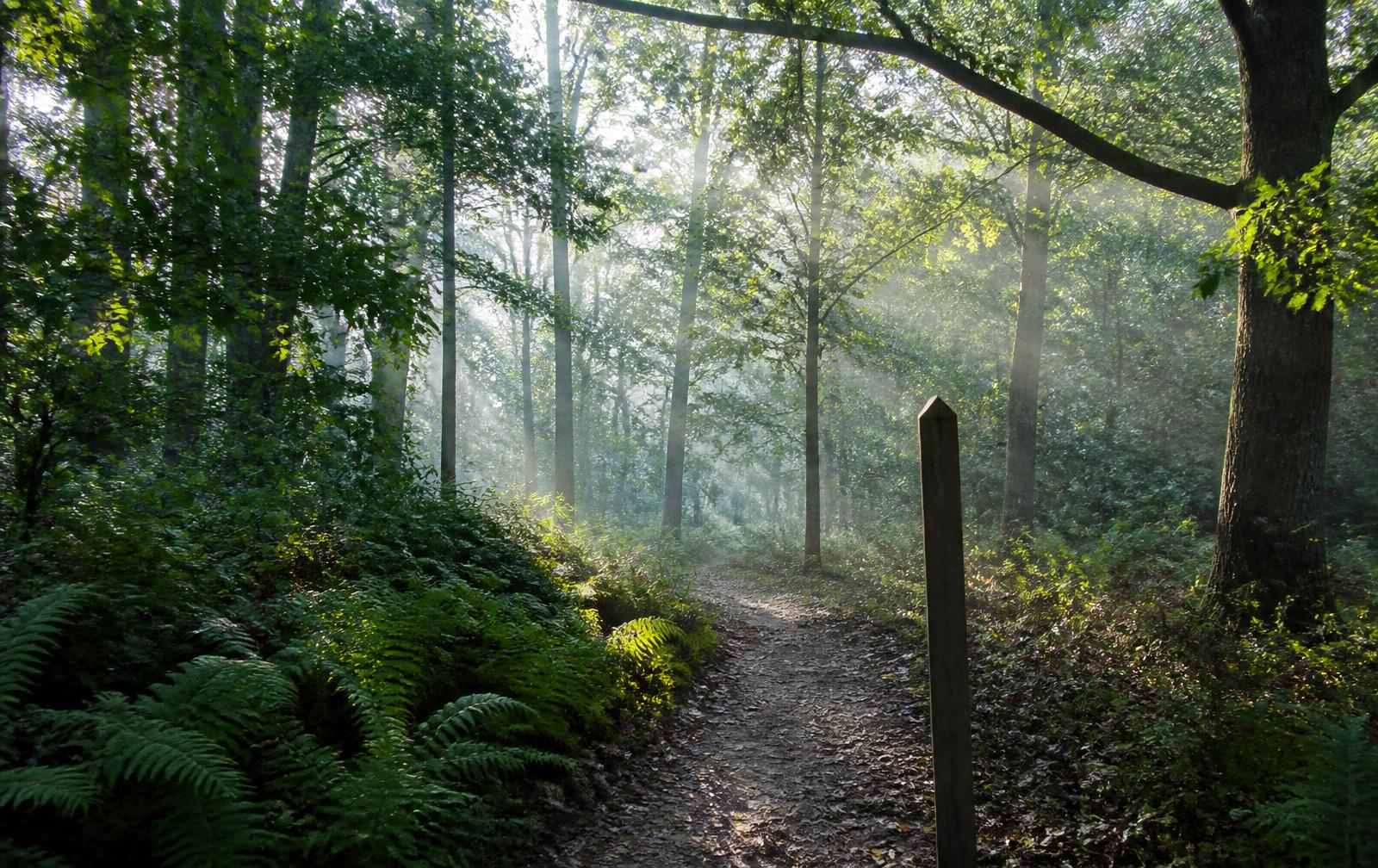
Soft-surface hiking trail winding through a Piedmont hardwood forest in morning mist

Trails & Hiking

Twenty miles of trail, all of it behind the gate.

The preserve loops, shoreline routes and everyday walking paths that make the forest at The Sanctuary something residents use daily rather than simply look at.

Most communities describe their green space in acres. The number that actually matters is how far you can walk without repeating yourself, without crossing a public road, and without meeting anyone who does not live here. At The Sanctuary that number is roughly twenty miles of private trail, laid through permanently protected hardwood forest that wraps the homesites and runs down to the Lake Wylie shoreline.

How the Network Is Laid Out

The trails are built as connected loops rather than as one long linear path, which is the single most useful thing to understand about them. From any trailhead you can assemble a twenty-minute walk before work, a five-mile run, or a two-hour ramble that touches the preserve interior, the shoreline and the amenity village in one circuit. Camp Sanctuary functions as the practical hub — residents leave from the pools and lodge, take a loop, and come back to the same place.

Surfaces vary deliberately. Wider graded paths near the amenity core carry strollers, dog walkers and casual evening traffic. Narrower soft-surface single-track runs deeper into the preserve, where the canopy closes overhead and the noise of everything else disappears within a few hundred yards.

Signature Routes

The Shoreline Walk

The most-used route in the community, and the one to do first. Segments run within sight of the water, connecting the lake beach and the Camp Sanctuary launches, with long views across coves that stay quiet because the opposite bank is protected forest rather than back yards. Best at sunrise, when mist sits on the water and herons work the shallows. Roughly an easy hour at a conversational pace.

The Preserve Interior Loop

The deep-woods option: mature oak, hickory and poplar, ravine crossings, ephemeral creeks after rain, and the steepest grades the property offers — which is to say moderate, rolling Piedmont terrain rather than anything technical. This is the route where deer and turkey are most reliably seen and where the forest feels genuinely remote despite being twenty-five minutes from Uptown Charlotte.

The Amenity Connector

Short, graded and the workhorse of daily life here. It links residential lanes to the pools, courts and lodge on foot, which is why so many residents walk to the amenity village instead of driving. Stroller-friendly end to end.

The Long Circuit

Chain the preserve interior to the shoreline and back through the connector and you have a substantial half-day walk without leaving the property. Carry water in summer; there is real shade the whole way, but the humidity is Carolina humidity.

Difficulty and Footing

Nothing here requires hiking experience or equipment beyond decent shoes. Grades are gentle to moderate, and footing is soft — leaf litter and packed earth, with roots and short pitches on the ravine and shoreline segments. Runners like the surface precisely because it is easier on joints than pavement, and the elevation change is enough to make a five-mile loop count as training rather than a stroll.

Wildlife Along the Way

The preserve is protected in perpetuity, and it behaves like it. White-tailed deer are constant. Wild turkey move through in flocks. Red and gray fox work the edges at dusk. Overhead: barred owls calling at first and last light, pileated woodpeckers hammering deadwood, osprey and bald eagles fishing the lake. Spring and fall migration push a remarkable range of songbirds through the canopy, and residents who keep a list add to it steadily.

Walking the Trails by Season

Trail Etiquette

Why Protected Land Changes What You Own

Preserve acreage here is set aside as permanent open space in the master plan rather than banked as future development inventory. That distinction is the entire value proposition of a preserve-adjacent homesite: the wooded backdrop behind the house is the view you keep, and the trail at the property line is infrastructure that will not be replaced by a cul-de-sac. Buyers comparing homesites should walk the trail behind each one before they compare anything else.

Signature routes in the preserve
RouteDistanceDifficultySurface
Shoreline Walk≈1.4 milesEasyPacked earth, some boardwalk
Amenity Connector≈0.8 milesEasyCrushed stone
Preserve Interior Loop≈3.2 milesModerateNatural singletrack with roots
Long Circuit≈5.5 milesModerateMixed singletrack and connector

Distances are schematic and approximate, not surveyed GPS.

Interactive Trail Map

The four signature routes.

Select a route to see its distance, difficulty, surface and trailhead. The map is a schematic of the network inside the gates — use it to plan, and ask for a guided walk to see the real thing.

LAKE WYLIENATURE PRESERVE

Schematic — not to scale. Tap a trailhead marker for details.

The Shoreline Walk

Easy
Distance
3.1 miles
Typical time
About 1 hour
Elevation
~110 ft gain
Surface
Soft earth, short boardwalk sections
Trailhead
Lake Beach trailhead, below Camp Sanctuary

Cove views, the lake beach, herons and osprey at first light.

Plan Your Walk

One-click itinerary planner.

Choose how long you have and when you want to start. We sequence the signature routes and trailheads into a walk that flows, with realistic times for each leg.

How long do you have?
Start time

Times are walking estimates on the schematic network, not surveyed GPS.

2 hours from 8:30 AM

About 2 hours · ~4 miles · ends 10:30 AM

  1. 8:30 AM

    5 min

    Start at Camp Sanctuary

    Water refill, restrooms, then out on the connector.

    Nearby: Lodge & restrooms · Pools and courts · Shaded parking · Water refill station

  2. 8:35 AM

    18 min

    The Amenity Connector

    Amenity Connector to the trail junction — an easy warm-up.

  3. 8:53 AM

    60 min

    The Shoreline Walk

    The Shoreline Walk in full — herons, osprey and the boardwalk sections.

  4. 9:53 AM

    15 min

    Break at the Lake Beach

    Swim area, benches along the cove, picnic shelter for a snack.

    Nearby: Sand beach & swim area · Kayak and paddleboard racks · Picnic shelter · Benches along the cove

  5. 10:08 AM

    18 min

    The Amenity Connector

    Connector back through the amenity core.

  6. 10:26 AM

    4 min

    Wrap at the lodge

    Pools and courts are steps away if you want to keep going.

    Nearby: Lodge & restrooms · Pools and courts · Shaded parking · Water refill station

Frequently Asked

Questions About The Sanctuary

How many miles of trails are there at The Sanctuary?+

The community maintains roughly 20 miles of private trails threading the nature preserve, connecting the amenity village, the shoreline and the residential lanes. Because the network is looped rather than linear, residents can build a 20-minute walk or a two-hour hike from the same trailhead.

Are the trails private to residents?+

Yes. The trail network is private to the community and is maintained for residents and their guests rather than the general public, which is why the trails stay quiet even on beautiful weekends when regional parks are crowded.

How difficult are the hiking trails?+

Most of the network is easy to moderate — rolling Piedmont terrain with soft footing, short climbs and gentle grades. A few shoreline and ravine segments have steeper pitches and roots, but nothing requires technical hiking experience or equipment.

Can you walk the trails with a stroller or a dog?+

The wider, graded paths near the amenity village handle strollers and are comfortable for everyday dog walking. Narrower single-track through the preserve interior is better suited to walkers, runners and leashed dogs than to wheels.

Are the trails suitable for running and mountain biking?+

Runners use the loops daily, and the soft surfaces are easier on joints than pavement. Recreational cycling is common on the community's lanes and wider paths; the preserve's narrow interior segments are managed primarily for foot traffic.

What wildlife might I see on a walk?+

White-tailed deer, wild turkey, red and gray fox, great blue heron, osprey, barred owls, pileated woodpeckers and, on the shoreline, bald eagles working the lake. Spring and fall migration bring a notably wide range of songbirds through the hardwood canopy.

Is the nature preserve permanently protected?+

Yes. The preserve acreage is set aside as permanently protected open space within the master plan rather than held as future development inventory, which is what guarantees the wooded backdrop behind homesites will not change.

When is the best time of year to hike here?+

October through April is exceptional — cool air, open sightlines through bare hardwoods and no insects. Summer walks are best early or late in the day, when the canopy holds the shade and the lake air moves through the lower trails.

Are there trails along the Lake Wylie shoreline?+

Yes. Several segments run within sight of the water and connect to the lake beach and Camp Sanctuary launches, making a shoreline loop one of the most-walked routes in the community.

Do the trails connect to the amenity village?+

They do. Camp Sanctuary functions as the practical hub — residents leave from the pools, courts and lodge, take a loop through the preserve and return without ever crossing a public road.

Walk the preserve before you choose a homesite.

The trail behind a lot tells you more than any plat map. Ask for a guided walk through the preserve and shoreline loops.

Continue Exploring

Related Reading

Sources

Primary sources cited

Facts on this page can be verified against the agencies, districts and utilities that publish them.

  1. 01Catawba Lands ConservancyCatawba Lands Conservancy. Conservation easements and permanently protected land in the region.
  2. 02Lake Wylie / Catawba region public landsMecklenburg County Park & Recreation. Nearby public trails, greenways, nature preserves and boat access.
  3. 03South Carolina State ParksSC State Parks. Nearby state park trails, camping and lake access in York County.
  4. 04Audubon North CarolinaNational Audubon Society. Regional bird species, migration timing and habitat guidance.
  5. 05Leave No Trace outdoor ethicsLeave No Trace Center for Outdoor Ethics. Trail etiquette and low-impact use principles.

Keep Reading